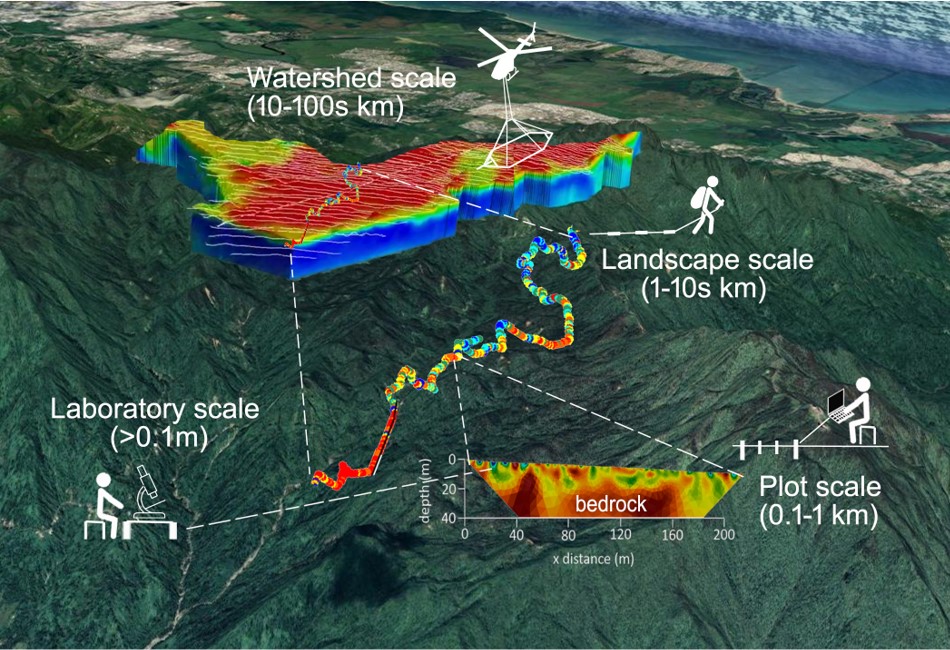
The critical zone is defined as the near-surface environment extending from the top of the trees down to the bedrock, and typically involves complex interactions between rock, soils, water, air, and living organisms. In our lab, we use an array of hydrogeophysical tools to image the critical zone, from the trees above the ground, to the geological materials and structures below the ground. We also use these measurements to capture and monitor a variety of physical and hydrogeochemical processes, from moisture content in soils and trees, to gas accumulation and fluxes in peat soils, or dissolution features in karst materials.
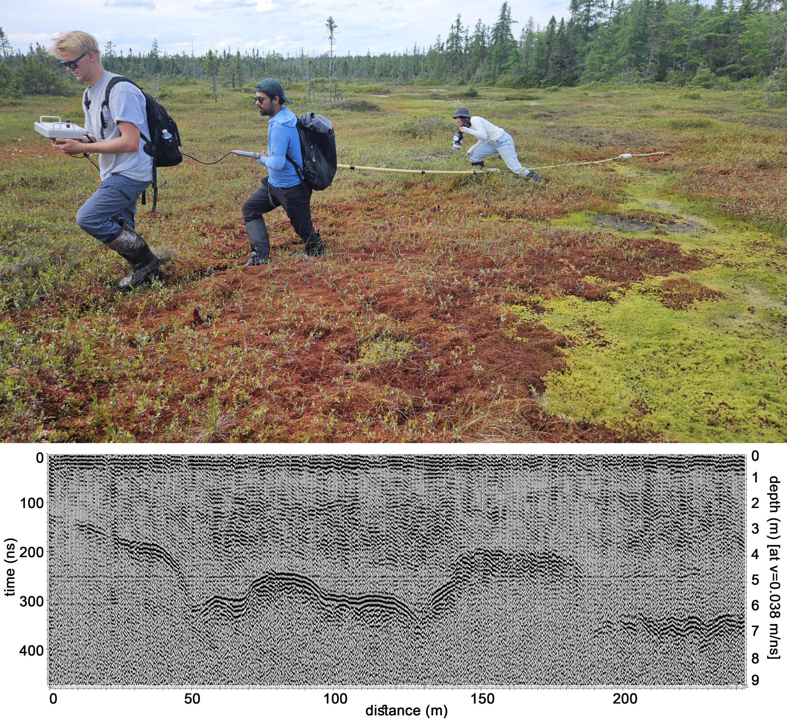
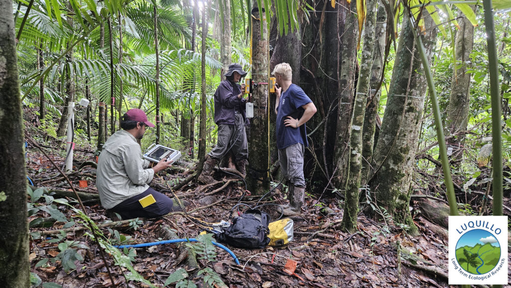
We apply a variety of ground-based and airborne techniques at multiple scales of measurement that include electromagnetic methods like ground-penetrating radar (GPR) and terrain conductivity, electrical methods like electrical resistivity, magnetic methods, and shallow seismic methods. These methods are constrained with other field-based techniques like direct coring and hydrological wells and sensors, as well as laboratory measurements.