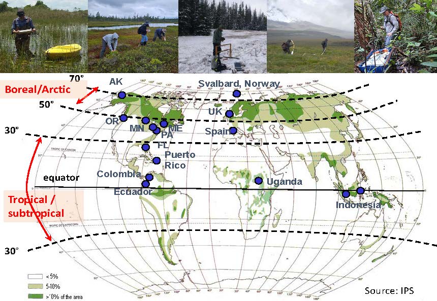
Current projects in our lab include: a) peatland studies (focusing on carbon stocks and fluxes) across latitudinal gradients in the US from the Florida Everglades to Alaska, including boreal systems in Maine and Minnesota; b) studies that explore the critical zone architecture, and the spatial and temporal variability in moisture content distribution in soils and trees in Puerto Rico (including the Luquillo LTER); or c) the characterization of dissolution features and sinkholes in karst environments in a variety of locations (including Florida and other international locations such as Spain).
a) Peatland studies:
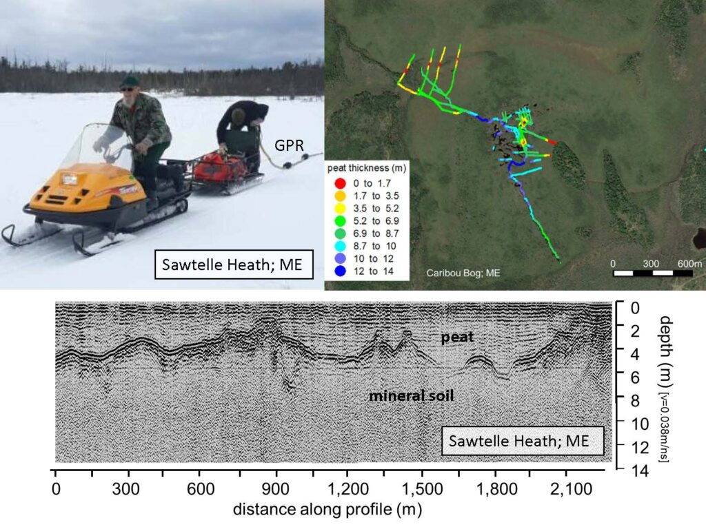
a1) Carbon stocks: critical zone architecture in peatlands
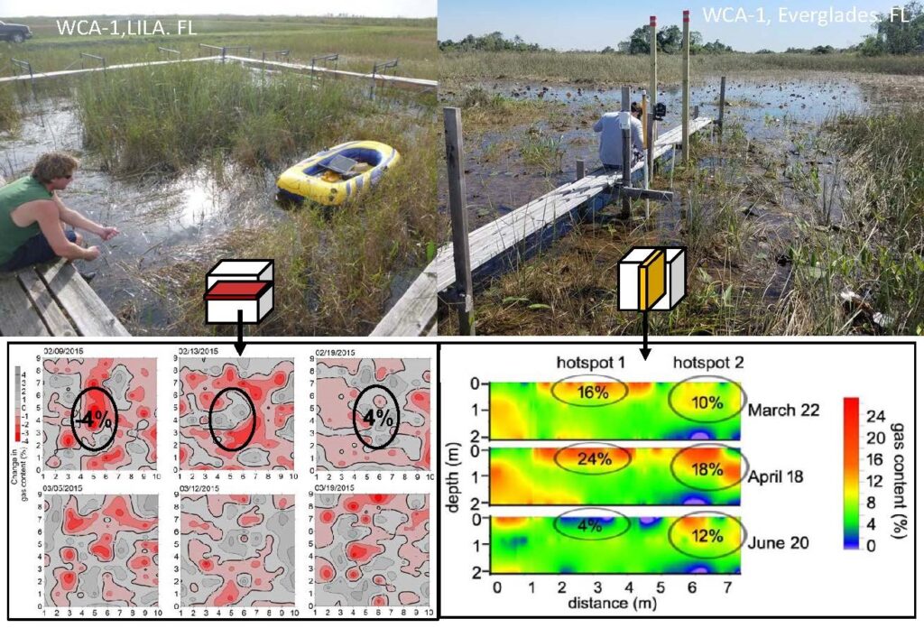
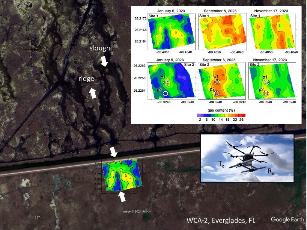
a2) Carbon fluxes: spatial and temporal variability of biogenic gases in peat soils
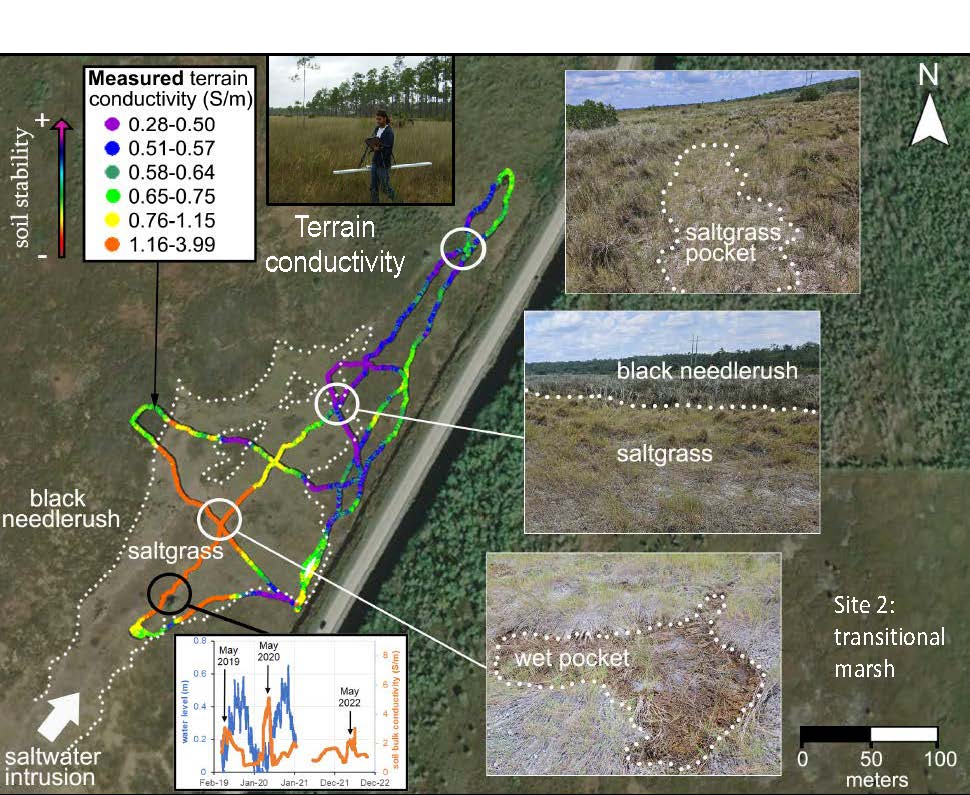
a3) Effects of salinity for peat stability: implications for peat collapse
b) Critical zone geophysics in Puerto Rico:
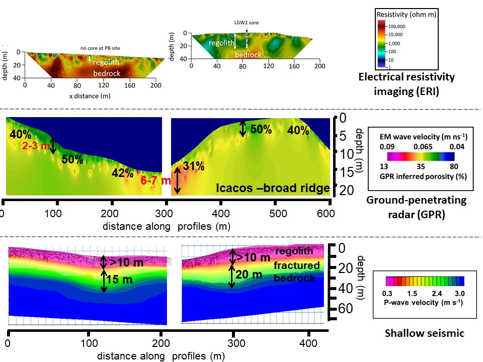
b1) Bedrock/regolith architecture at the Rio Icacos
b2) Spatial and temporal distribution of moisture content in soils of the LTER in Luquillo (PR)
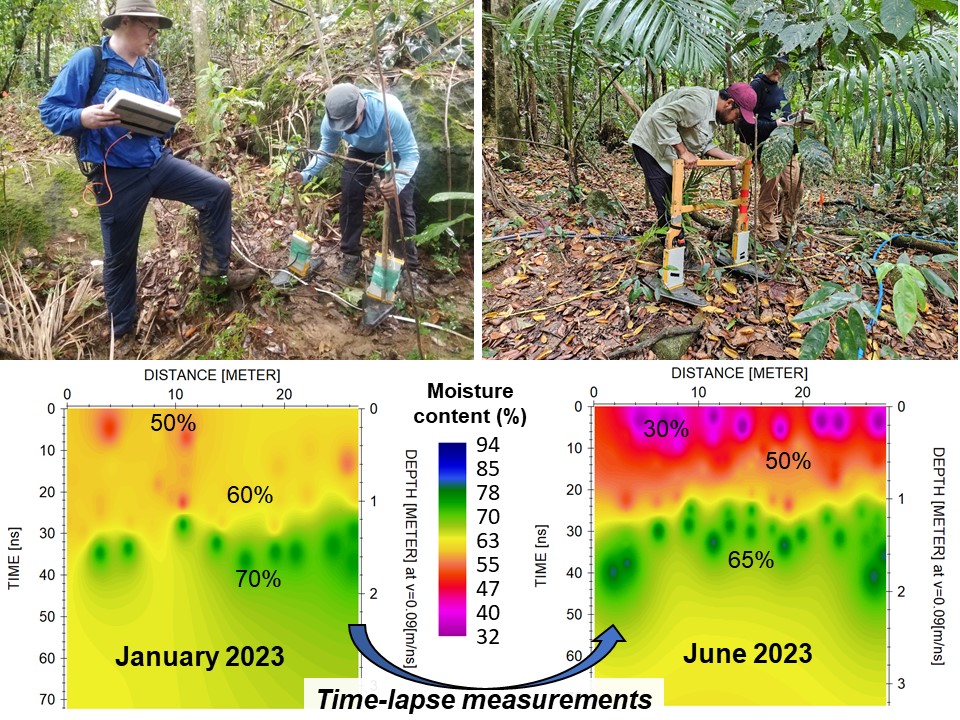
Changes in moisture content distribution in soils inferred from ground-penetrating radar (GPR) measurements.
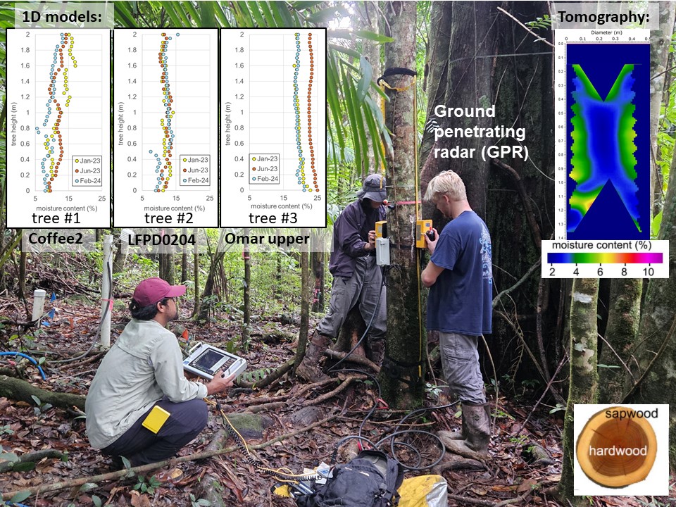
b3) Spatial and temporal distribution of moisture content in trees of the LTER in Luquillo (PR)
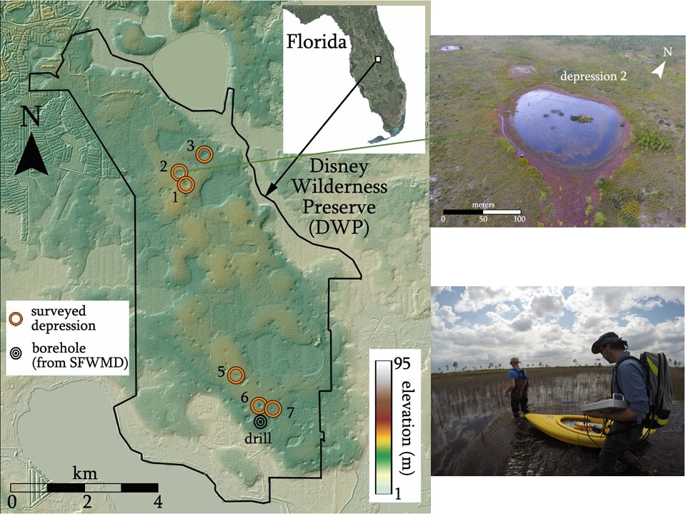
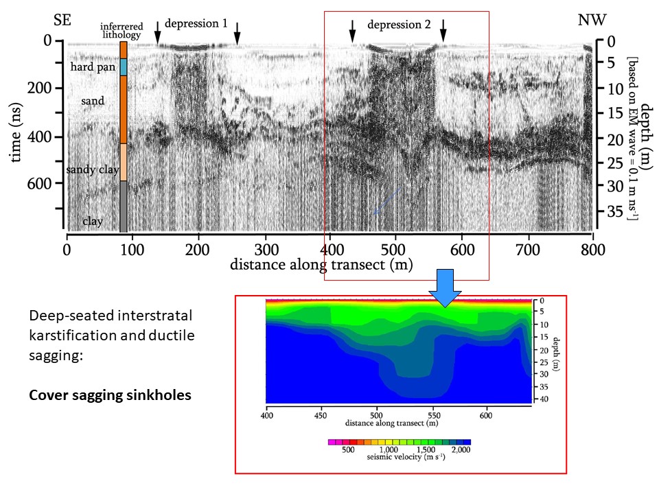
c) Dissolution features and sinkoles in karst environments
c1) Sinkhole characterization
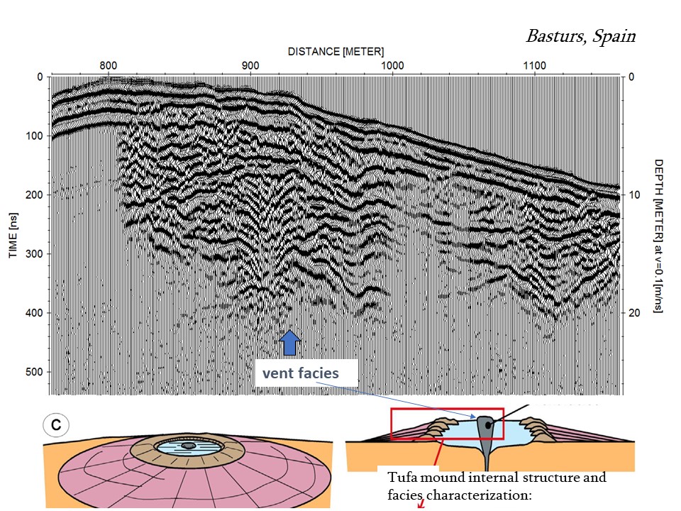
c2) Subsurface characterization of other karst features: tufa mounds